Image

Italian Bar Gorge Scramble, July 20-21, 2013

Gorge Scrambling on the North Fork of the American, by Elaine Gorman

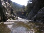
I had some trepidation as we began hiking down the Mumford Bar trail, on the way to my first overnite gorge scramble.   Gorge scrambling is a combination of hike and float trip.    Add a backpack.   Plus slippery rocks.   Throw in poison oak and possible rattlesnakes.   What makes everything worthwhile is a wild canyon devoid of trails and people.

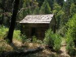
After Delta-Sierra outings leader Paul Plathe gave a short introduction to our group of 8, we hit the trail.  On our way to the river, we hiked through an area burned by the American River fire of July 2008).   There was quite a bit of blowdown, so dodging poison oak, scratchy brush, and logs became quite a challenge.   I am still sporting a huge knot on one shin from kicking a log buried in brush.  After 3.8 miles and 3200 feet of elev. loss, we arrived at the river.  We checked out the Mumford Bar cabin.   The outside was in good repair, but the floor was missing.

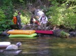
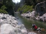
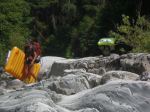
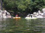
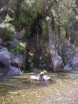
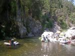
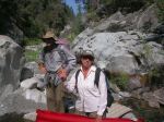
After blowing up our air mattresses/rafts, and a quick lunch, we belly-flopped on to our air mattresses/rafts and headed downstream.   The water was refreshingly cool after our hot hike into the canyon.   Veteran gorge scramblers Russ, Ron, and John expertly navigated the boulders and shallows.   Ted was the “king of the river” on his inflatable twin mattress cum throne, and was able to sit up quite royally with his pack wedged behind his back.   Newbies Jens and Diggie soon got the hang of ‘scrambling after some instruction by Paul.   I just tried to keep up.

We saw several garter snakes, one swam next to us with a small fish in its mouth.   Frogs and tadpoles were abundant.   Pines clung to the steep canyon walls, defying gravity and wind as best they could.   After about 90 min. of floating and rock hopping, we camped on a sand and gravel bar.   We had a small campfire for cooking and ambience.  Dinners ranged from dehydrated packaged meals, to cheese and crackers.   John’s kielbasa-on-a-stick earned him quite a few chuckles.   Thankfully, the almost full moon was hidden behind the canyon walls and we had a dark sky for sleeping.

Back on the river by 9 am the next morning, we floated another few hours until we reached the Marrs mine and stamp mill at Italian Bar.  The remaining milling equipment was a 3 stamp, stamp mill. The mine extends for a couple hundred feet into the canyon wall.   We walked along the old ore cart rails, marveling at the work the miners endured as they dug and blasted through rock and mineral.

We couldn’t delay our hike out of the canyon any longer.   The 2.5 mile Italian Bar trail, with almost 2700 feet elev. gain seemed much longer and steeper with our bruises and aching muscles.   The vehicles were a welcome sight.    Many thanks to Paul for leading such a fun, interesting and wild adventure.


020

021

022

023

024

025

027

028

030

031

Clavey River (God’s Bath) August 18th 2012


There were 10 participants: Elaine, Michael, Derek, Tom, Roger, Russell, and Jessica : and some newcomers to gorge scrambling: Janelle, Ted and Lark. Unfortunately, because of back problems , our gorge scrambling leader, Paul, was not able to join us on this adventure. We carpooled from Oakdale then met Elaine at Tuolumne City. From there we went southerly in 3 vehicles the 40 minutes drive alongside scenic canyons to the bridge over the Clavey river gorge. Here we left one vehicle and traveled along the ridge road paralleling the river. We found a gently sloping forest road leading down to the river and spent nearly an hour hiking down . Just before reaching the river we took a steeper single track down. Eventually this trail petered out. Lark discovered a way down the steep embankments by crossing over a creek on a fallen log and then sliding down another log to the river bed. It turns out that we had got to the river well upstream from where Paul had planned for , so we had a very long scramble ahead of us. Once we reached the river we were able to find a good spot in the shade for lunch. While temperatures during the week had been around 100, we were fortunate to have a mild day of around 80 degrees (although a bit muggy). Unlike a lot of the other gorge scrambling outings (which involve a great amount of floating down the river on airbeds) this trip is rock scrambling all the way apart from a couple of spots where a very short swim is the easiest and safest way downstream. As is often on these trips, Russ led the way down the river. He was joined by newcomer Ted who amazed us all by his nimble scrambling on his preferred hiking footwear: flip-flops! In the first part of the outing the water was quite shallow with a wider valley. We were even able to walk along the shore at times and make quicker progress than walking in the river bed. The last half of the trip was in much more of a canyon/gorge. There was much more water flow with numerous tempting swimming holes, however because we were concerned about getting back before dark we only stopped a couple of times for a refreshing swim. In the last half the rock scrambling became more challenging, and a lot of fun. Toward the end of the trip the gorge was narrow with rocky cliffs, and lovely pools. At many places you wished you could just hang out all day and absorb the beauty that no landscaper could ever duplicate. After about 7 hours of scrambling we finally got to our destination: God’s Bath. Gods Bath is a very popular swimming hole. We arrived about an hour before dusk. Here we had two of our most challenging and memorable spots: one was climbing down a 6 foot waterfall with the water rushing over you. The other was a very narrow rock crossing :  just wide enough for your feet with a high drop off on either side to pools of water below. Some just “went for it”, others sat down and slid across, others were helped by the friendly locals who were hanging out swimming at the pool. Because we still had time before dusk we stopped at God’s Bath for about 40 minutes to swim and play.  God’s Bath has to be one of the best swimming holes anywhere. It is a beautiful narrow canyon a large smooth rock slab to hang out on, with rocky cliffs on either side. There are two pools, a large one “the tub” and another smaller one “the pot hole” that can be reached by swimming underwater, under the rock slab. Here is a link to photos and video which show some to the beauty of God’s bath http://swimmingholesofcalifornia.blogspot.com/2010/08/gods-bath-sonora-ca.html With darkness approaching we reluctantly left God’s Bath and went the last ½ mile or so  downstream to the bridge where we were able to work our way up the canyon wall to where we had left the one of our shuttle vehicles. After the hike a few went to Black oak casino in Tuolumne for dinner- others needed to get home While it had been a long challenging day – it had been really enjoyable. Jessica liked God’s bath so much she was planning to go back the next weekend. Some participant comments: ………Yes although a bit exhausting, I had a wonderful day! This was my first but will definitely not be my last gorge scrambling. It was a pleasure meeting everyone for a grand adventure – Janelle. …………I had a really fun (& exhausting!) day yesterday, thank you to everyone for helping me get through the Clavey without TOO many scratches and bruises – Elaine.

Derek Castle

Mumford Bar to Iowa Hill

Outing Report for the July 12-15, Thursday – Sunday. Gorge Scramble (Level 3) – Mumford Bar to Iowa Hill. Participants (6). Bill W, Ian R, Mike M, Ron F, Russ G, and myself. There was a heat wave of 3 to 4 days of 100 degree Fahrenheit weather before the outing and for the outing itself we had air temperature highs starting at 100 descending to about 95 degrees on the last day. Water temperatures throughout the 4 day trip were very pleasant, no wetsuit necessary. Total river miles 20. Total trail miles 10. Saw maybe 6 miners working the gravel bars spread out along the river starting from Pickering Bar to the Stevens Trail crossing, we saw no dredges.

July 12,
3.75 trail miles, 3.4 river miles. A change in the shuttle arrangement due to a fire in Shirttail Canyon. Iowa Hill was under threat of evacuation and the Iowa Hill Road was closed at Canyon Way in Colfax. We left vehicle at the Cemetery near the Stevens Trailhead and used it for our exit rather than Iowa Hill as previously planned. This lengthened our shuttle substantially. We hiked in on the Mumford Bar Trail, the Government Springs Fire of 2008 had left significant areas along the trail exposed to the sun and new undergrowth has developed making the trail near the canyon bottom difficult to follow. The John Mumford circa 1868 miners cabin survived the fire however the mosquitos that had plagued visitors to the cabin did not survive the fire. We accessed the river from the cabin and gorge scrambled down to Italian Bar and explored the Marrs Mine. No sand for camping there, however we found a good sandy spot down canyon from there.

July 13,
6.6 river miles, We were on the river by 8 am. We gorge scrambled from near Italian bar thru the American Eagle Gorge, ate lunch and toured the mine near there. We also toured the Southern Cross mine and found camp down canyon from the Euchre Bar Bridge just before the start of Euchre Gorge.

July 14
5.6 river miles, 2 trail miles. We went thru Euchre Gorge into Green Valley and toured the cabin on the river left off the Green Valley trail. Then into Giant Gap eating lunch at a rapid called locomotive some where near the middle of the gorge. Then on to Canyon Creek and Pickering Bar. Wanting to get further down canyon we picked up the Pickering Bar Trail on river left and walked it 2 miles to the area near the bottom of the Blue Wing Trail. We camped in a big sandy area near a large pool just down canyon from the Blue Wing Trail junction.

July 15,
4.25 river miles, 4.5 trail miles. We broke camp and starting Gorge Scrambling about 8 am and we got to the Stevens Trail about noon, ate lunch and hiked out to the Colfax TH arriving about 3pm, undid the shuttle and went home.

To view photo’s click on it, use the back button to return.

Marble Point, Mokelumne River

Marble Point, Mokelumne River.

July 7, 2012 – This is our second gorge scramble of the Marble Point Section of the Mokelume. We were 17 participants, Pat M, John S, Tom M, Steve D, Paul W, Russ G, Joey and Jessica A, James C, Koura F, Elaine G, Derek C, Annelea V, Marcy B, Kathy S, Gene A, and myself. The river is gently descending at 28 feet per mile, a 3 mile section of mostly gravel/rock bar drops with one notable rapid near Marble Point. It offers lots of floating thru long pools and rock bars that can be walked. Some would describe it as a “floaty” trip. The elevation is low by our standards at 800 feet near Watkins Bar. Our temperature forecast for the day of the outing was 97 degrees, water temperature was pleasant and the required release of about110 cfs was perfect for our activity. The Marble Point section gave us good solitude between Marble Point and Ponderosa Way. We did not see anybody other that our party between these two points in the river. Different from a free flowing river, vegetation was very established, lining the sides of the river due to the lack of flushing flows.

We did take half of the route going down into in cross country thru the poison oak to get directly into the main canyon. There are poison oak afflicted participants. The estimated time to complete the river portion was 3 to 5 hours. I am happy to report our large group got it done in 4 hours. Plus we had complicated shuttle due to the high clearance vehicle requirements for the last few miles which was pulled off with out any problems.
We got our 17 Sierra Club outing participants to the Hotel Leger Bar and Restaurant in Mokelumne Hill for beer and dinner about 6 pm.

The Foothill Conservancy is making an effort to get Wild and Scenic Status for this river, for more information and to participate in their efforts go to their website.

It was a good outing and we would do this again some day.


Giant Gap, North Fork American Wild and Scenic River Canyon.

August 27, 2011 – Saturday. Giant Gap. The outing was lead by Ian, participants were Paul, Russ, 2 Toms, Arlen and Cody. We got an early 7 am start and with all of us being capable gorge scramblers we completed the Giant Gap day trip in time to eat dinner in Auburn at 8:30 pm. We did the outing off I-80 using the Green Valley trail to get into the canyon and the Pickering Bar trail to exit. The water temperature was acceptable for use without wetsuits. The air temperature forecast for Sacramento that day was 98 degrees, which was excellent for our activity. There were several side streams that had water that I do not recall from past outings, Canyon Creek had plenty of water as usual. The estimated flow for the North Fork American at Giant Gap was 100 cfs for that day. It was a strenuous outing but a satisfying accomplishment.

For a slide show of our outings go to;

https://picasaweb.google.com/112166053606076082270/GiantGapAugust272011?authuser=0&feat=directlink

Marble Point, Mokelumne River.

August 13, 2011 – This was our first gorge scramble of the Marble Point Section of the Mokelumne. We were 9 participants. John, Claudia, Wayne, Ian, Kathy, Stephanie, Cassandra, Elaine and myself. The river is gently descending at 28 feet per mile, a 3 mile section of mostly gravel/rock bar drops with one notable rapid near Marble Point. It offers lots of floating thru long pools and rock bars that can be walked. Some would describe it as a “floaty” trip. The elevation is low by our standards at 800 feet near Watkins Bar. Our temperature forecast for the day of the outing was 90 degrees, water temperature was pleasant and the required release of 40 cfs was perfect for our activity. The Marble Point section gave us great solitude. We did not see anybody other that our party from trail head to trail head. Different from a free flowing river, vegetation was very established, lining the sides of the river due to the lack of flushing flows.

Cool Mokelumne
Blazing solar energy
Riverine caress.
Leaks in air mattress
Slippery, lurking boulders
Bruised knees, bloody legs.

By Elaine Gorman

At the end of Ditch Road #5 we descended the slide trail. It brought us into the South Fork at a miners camp a short distance from the Mokelumne River. The gorge scrambling in the South Fork is just brutal. The next time we will take the ridge down that is closest to the Mokelumne.

On Ponderosa Way near CC Bridge John’s pickup got stuck in rather deep rut. The nine of us helped get him going back up the hill. We had enough high clearance vehicles to get all of us up Ponderosa Way to Hwy 26.

We got our Sierra Club outing participants to Jeff Tuttles Union House in Mokelumne Hill for dinner about 7 pm. We enjoyed good food and conversation at the center of the universe. It just happened that Carl Pope the former Executive Director of the Sierra Club was having dinner there also. We said hello.

The Foothill Conservancy is making an effort to get Wild and Scenic Status for this river, for more information and to participate in their efforts go to their website.

It was a good outing and we would do this again some day.

For a slide show of our outing go to;

https://picasaweb.google.com/112166053606076082270/MarblePointAugust132011?authuser=0&feat=directlink

Cosumnes Falls

August 2, 2011 – Tuesday. Eight of us gorge scrambled the Cosumnes River downstream of Hwy 49 to Cosumnes Falls and back. The rock in the river bed was different than what we were accustomed to in other areas of the motherlode. John, Claudia, Wayne, Russ, Rita, Ron, Randy and I did the outing. The water temperature was almost bathtub warm. Most of us used air mattresses to get down canyon to the falls. A very old and  well built ditch was used on canyon right to access the bottom of the Cosumnes Falls. The route back was mostly by trail on river left.  Thanks to Randy Smith for bringing forward the great idea to do this outing and for providing the excellent photo’s of the outing. Please use the link below to view Randy’s photo’s. 

https://picasaweb.google.com/112166053606076082270/CosumnesFalls2011ByRandySmith?authuser=0&authkey=Gv1sRgCLTh4_e5gsPvAg&feat=directlink

Silver Dollar Gorge, Duncan Canyon

July 16, 2011. Saturday. Silver Dollar Gorge, Duncan Canyon Level 2 Motherlode Chapter Gorge Scrambling Section. We were 10 participants. This is an easy outing by our standards and we had several newcomers. The temperature was in the low 80’s and sunny. Placer County Water Agency has a dam upstream of our outing used to send water to French Meadow Reservoir. Due to operational issues they were not removing water from Duncan Creek. The flow below the dam and for our outing was 70 cfs. The river canyon was scrambled from the Gold Dollar Trail to the usual stopping point for this outing. There were no problems, all had a good time and we returned to Auburn in time for dinner at a local restaurant. Click on the link below to view additional photos of the outing.
https://picasaweb.google.com/112166053606076082270/DuncanCanyon?authuser=0&authkey=Gv1sRgCOP2se2FkZrougE&feat=directlink


Gates of the Antipodes and Box Canyon #1.

August 28-29, 2010. Saturday-Sunday. Gates of the Antipodes and Box Canyon #1. Gorge Scramble Level 3. Motherlode Chapter Gorge Scrambling Section. Middle Fork Yuba river canyon. We were 5 participants. The weather was terrible. High temps were in the 60’s to low 70’s rain and overcast the entire two days. Due to the weather the outing was adjusted at the last minute to doing only the Gates of the Antipodes and to camp there. This involved one required swim of about 60 feet minimizing our exposure to the cold water getting to camp. We did manage to do a short gorge scramble up thru the narrows and back to camp with out major problems.

Iowa Hill

August 14, 2010. Saturday. Iowa Hill, Gorge Scramble Level 3. Motherlode Chapter Gorge Scrambling Section. North Fork American Wild and Scenic River Canyon. There were 4 participants, Alex, myself and a pair of Chatty Kathy’s. We began our outing with a quick tour of the bathrooms at the Iowa Hill Store and then onto the Old Iowa Hill Cemetery which included obituaries of some of the occupants. Tombstones date back to the 1850’s. Our trail which starts in the Cemetery and out the back of it becomes the Booth Trail descending a steep wooded ridge line to the North Fork American offering several good views of the canyon below. Arriving at the river we prepared ourselves for the river portion of the outing, inflating our air mattresses and water proofing our gear. This section of river offers solitude, is about 2 miles in length and can be done with frequent stops to graze on the berries along the river, explore some of the rock and gravel bars. In addition we stopped to have adult storey time, reading aloud some of the obituaries of those buried in the Cemetery above. Arriving at our take out at the Stevens Trail about 4ish we took our time walking back to Iowa Hill, chatting and taking in the sights along the way. This outing is not complete without dining at the Iowa Hill Store. For $8 each we dined on beef brisket, baked potato, stir fried vegetables, and salad. It was excellent food in the rustic atmosphere of Historic Iowa Hill.